| Field layer: | |
| Select MCDA option |
| Field layer: | |
| Select MCDA option |
New Criteria
Delete Criteria
AHP Weights
| Criteria | Weight | Subcriteria Min/Max Rel Weights Indifference (%) |
|---|
| Value | Rank | Comment |
|---|
| Criteria | Weight | Subcriteria | Min/Max | Relative Weights | Indifference (%) |
|---|
| Basic | Advanced | Watershed Extraction |
| Select folder (optional) : |
| Computation Mode: | ||
| DEM: | ||
| Outlet point layer: | ||
| Boundary Mask: | |||
| Outlet point layer: | |||
| Watershed: | |||
| DEM input raster: | ||
| Burn in stream layer (optional): | ||
| Output raster: |
| Filled DEM: | ||
| Flow direction raster: | ||
| Slope raster: |
| Flow direction: | |||
| Flow accumulation raster: | |||
| Flow direction: | ||
| Longest flow path: | ||
| Total length of flow paths: | ||
| Grid network order: |
| Filled DEM raster: | ||
| Flow Accumulation raster: | ||
| Peuker Douglas Stream Network: |
| Outlet point layer: | ||
| Optional: |
||
| Flow direction raster: | ||
| Move outlets to stream raster: | ||
| New outlet layer: | ||
| Flow direction raster: | ||
| Modified Peuker Douglas stream raster: | ||
| Outlet points: | ||
| Weighted contributing area raster: |
| Filled DEM raster: | ||
| Flow accumulation raster: | ||
| Flow direction raster: | ||
| Weighted flow accumulation raster: | ||
| Outlet points: | ||
| Drop table name: |
| Threshold (m2) | Drain Density (1.0E-2, m-1) | 1st order stream | Higher Order Stream | T value | |||||
|---|---|---|---|---|---|---|---|---|---|
| No. | Ratio(%) | Mean Drop (m) | σ of Drop (m) | No. | Mean Drop (m) | σ of Drop (m) | |||
| Weighted flow accumulation raster: | ||
| Stream Raster Grid: | ||
| Threshold (m2): |
| Filled DEM raster: | ||
| Flow direction raster: | ||
| Flow accumulation raster: | ||
| Stream Raster Grid: | ||
| Outlet points: | ||
| Stream Network: | ||
| Subwatersheds: |
| Flow direction raster: | ||
| Outlet points: | ||
| Watershed: |
| Store results in folder: | |||
| Perform the analysis only for the zone layer specified below: | |||
| Boundary Mask: | |||
|
Option 1: Trace the watershed on the map
Draw Tool:
Option 2: Use predefined NHD Hydrologic unit catalog:
|
|||
| Flow direction: | |||
| Pour Point: | |||
|
| |||


| Top: | |
| Left: | Right: |
| Bottom: | |
There are currently no crop fields that have been created to perform the operation. Please create a crop field by clicking on "Create Area" from the "Settings" tab and try again.
Crop Information
Irrigation Information
Soil Information
CoCoRaHS
Add Rain or Irrigation
Edit Existing Rain or Irrigation
Select Cutting Date(s)
Crop Development
Kcr Transitions
Current Conditions |
Below is a graph displaying your current plant available water or soil water deficit, depending on the option selected. To change the view select a different graph type from the "Select Graph" dropdown box below. Some graph series, such as rain and irrigation, are directly editable from the graph. Click and drag these lines to change their values or enter values directly in the “Table” tab.After changes are made, the “Update” button at the bottom should be clicked to save changes.
Available water content is calculated from subtracting permanent wilting point from field capacity to provide a value of water that is available to plants. (AWC = FC - PWP).
| Load an Existing Query: | ||
| Query Layer: | ||
| Select an Attribute: | |
| Operations: | |
| Attribute Values: | |
| Value: | |
| Query: | |
| Select Spatial Location Type: |
| By Selection: |
Buffer radius:
m
|
| By Geographic Location: |
| By Relationship: | |
| Layer: | |
|
Distance:
|
m
|
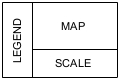
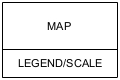
| Title: | |||||
| Created By: | |||||
| Date: | |||||
| Legend - Select Layers to Display | |||||
|
|||||
Choose Template
| Datum: | |||
| Coordinate System: | |||
| Zone: | Hemisphere: | ||
| X: | |||
| Y: |


Warning this download may a few minutes to complete depending on how many stations have been selected. Are you sure you wish to proceed?
There is an error in the inputs you provided. Please make sure at least one station is selected and at least one type of download data is selected.
