
Aaron Piña and Scott Denning
Department of Atmospheric Science, CSU
I. Compare IDF curves in SPRB from observations vs WRF vs MMF
We separated SPRB into 6 regions: mountains, foothills, low urban, high urban, plains E of low urban, and plains E of high urban.
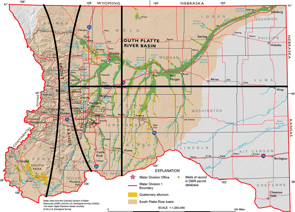
We will use weather research and forecasting (WRF) model as stepping stone to compare observations with MMF. WRF will be ran at 1-km horizontal resolution for the SPRB using initialized with output from the North American Regional Reanalysis (NARR) for 3 summer months (JJA) on NCAR’s Yellowstone supercomputer. If WRF captures observations well, which is the a priori assumption from using NARR data, we can use IDF curves from WRF to compare with those from the MMF. The desire for using WRF is to have a large number of samples (every 1 km) versus having to use coarse (spatially and temporally) observational data. We will need to run MMF for multiple summers to get a large sample set. We will also compare WRF vs MMF under land-use changes, where any anthropogenic-induced change to the land will be changed back to preindustrial land cover. From the figure below, we can see the land-use changes along the South Platte River in NE Colorado where there are irrigated crops; we also see urban centers along the Colorado Front Range.
II. Use MMF to calculate IDF curves through 2100 for SPRB
The MMF is not perfect, but it simulates reality better than global runs (e.g. CMIP5). We will compare IDF curves from MMF through the year 2100 with CMIP5 output and results presented in the National Climate Assessment, released by the US Global Climate Research Program. Comparisons to regional analyses released by international and national governments are especially important for optimizing the balance of water management between agriculture communities and municipalities.