Catena Public Layers
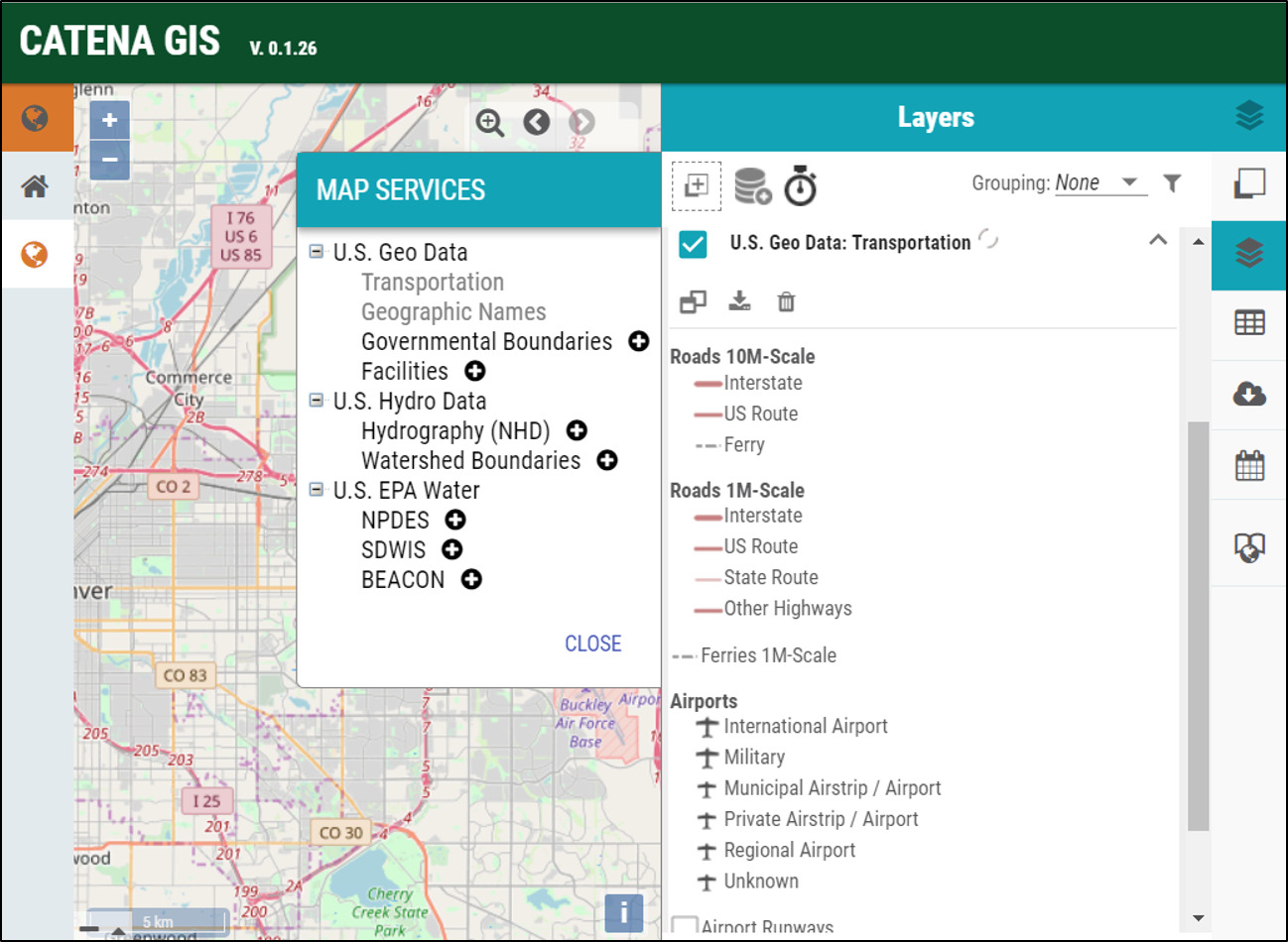
Public layers are sourced from publicly available national datasets and can be explored using the “Layers” icon located on the right dashboard. Once you have entered the Layer interface, individual geospatial layers can be added by clicking the database icon. Each item listed is a collection of layers that can be selected by clicking the “+” next to the item or deselected by removing the check box next to each item in the Layers pane.
These layers can be expanded by clicking the down arrow next to each item under the collection to display additional information as well as options to select attributes to visualize, adjust layer transparency, zoom to layer extent, and metadata about the map service providing the information.
Data can be extracted from public layers for further spatial analysis. Extracted data are stored as an item under the Geospatial Layers map tab, or if you are working in a project, as an item under the User or Project Layers map tab.