Catena Data
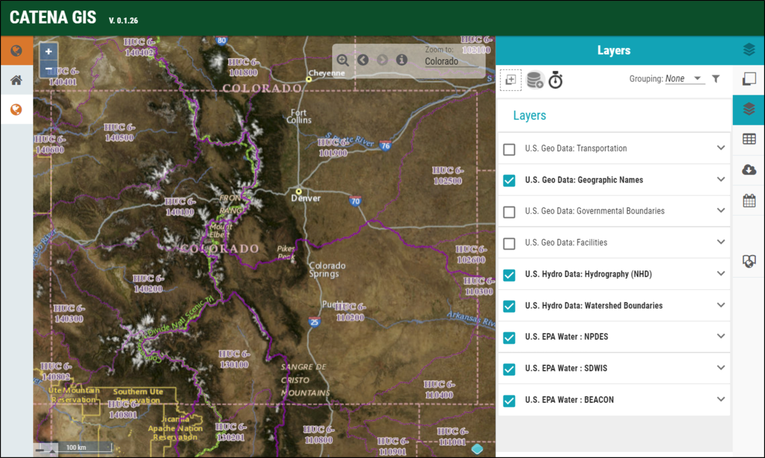
Catena-GIS includes point-and-click access to public base layers and datasets from multiple open-source data providers. You can upload, export, and modify data from these and other providers using symbology, heads-up digitizing, and creation of new layers from XY data. Time-series data can also be uploaded in table format and attached to features from a feature class dataset.
Below you’ll find more information about Catena-GIS layers and datasets.
LAYERS & DATASETS
Explore Other Products
Data Analytics & Modeling
State of the are modeling and software packages, data hosting and storage solutions for environmental resources planning and management.
Learn More
GIS Tools
Access numerous mapping and geospatial tools including common map operations and many types of geoprocessing tools.
Learn More
Content Management
Create, organize and share information seamlessly using our web-based platform with options for managing private and shared digital resources.
Learn More