eRAMS GIS Tools
Catena Analytics provides open-access to numerous GIS tools and analytical operations through our eRAMS interface. In addition to common map functions, several more complex geospatial analysis operations are available. eRAMS-GIS users can:
- Digitize and edit features
- Perform queries
- Add and create geospatial layers
- Create tables
- Execute geoprocessing and geostatistical functions
- Conduct network and/or terrain analysis
- Explore hydrology tools
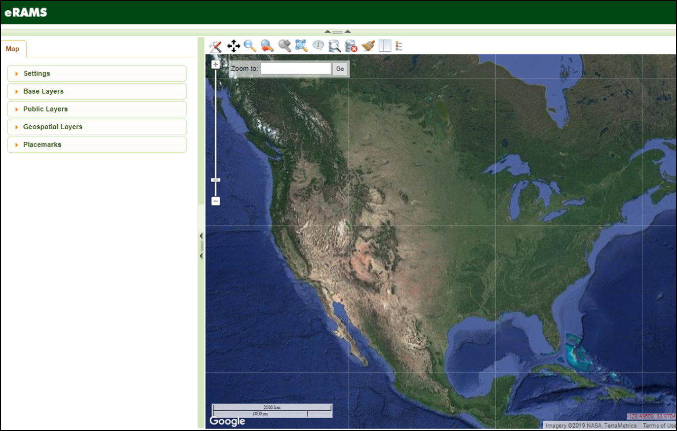
eRAMS GIS Interface
Map Settings

Map settings can be modified from the left dashboard under the Settings tab. The size of the map pane can be altered using the font size buttons and Distance and Area Units can be specified using the drop-down menus. A map scale can also be set by clicking in the Scale box and entering the desired value.
Layers

eRAMS includes point-and-click access to public base layers and datasets from multiple open-source data providers. You can upload, export, and modify data from these and other providers using symbology, heads-up digitizing, and creation of new layers from XY data. Time-series data can also be uploaded in table format and attached to features from a feature class dataset.
Map Menu

Several tools are provided along the top of the map canvas. A wide variety of common mapping operations are available to manage geospatial layers, select and view attributes, move between layers and add graphics or placemarks.
Toolbox

The first icon along the map menu is the toolbox, a collection of geospatial analysis tools. These analysis tools are available by clicking the “tools” icon which will display a drop-down menu. Once you select the desired analysis submenu items can be selected to display a pop-up window where specific parameters for using the tool can be entered.
Zoom

eRAMS GIS users have two options to adjust properties of the map canvas:
Zoom Scale Slider
The Zoom Scale Slider bar adjusts the map view, changing the spatial scale by moving the slider bar up to zoom in or down to zoom out.
Zoom to: Search Box
To zoom the map to an area of interest, a place name can be entered into the Zoom to: Search Box. If the location is known by the search engine, the map will zoom to that area of interest.
Explore Other Products
Data Analytics & Modeling

State of the art modeling and software packages, data hosting and storage solutions for environmental resources planning and management.
Learn More
GIS Data

Our platform includes automated access to public datasets and geospatial layers from multiple open-source data providers.
Learn More
Content Management
Create, organize and share information seamlessly using our web-based platform with options for managing private and shared digital resources.
Learn More