Raster

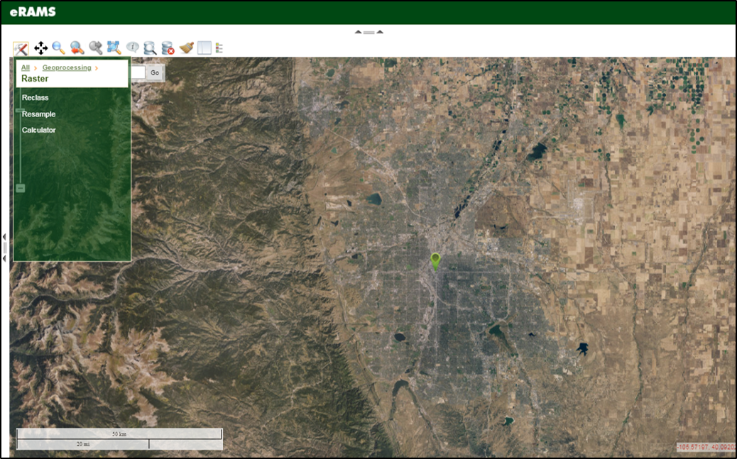
Geoprocessing operations can be performed on raster files. Rasters can be reclassed, resampled, and/or raster calculator functions can be performed.
To conduct raster file modifications, first select Geoprocessing from the Map Tools icon to open the toolbox. Select Raster and then select the tool or interest.
Below you will find detailed information on the raster operations available using the eRAMS GIS interface.
eRAMS Raster Operations
Reclass
The Reclass tool is used to re-assign a value or set of values in a raster to new output values. To access the Reclass tool, select Geoprocessing from the Map Tools icon to open the toolbox and then select Raster and click Reclass.
- The Reclass pop-up box will open prompting selection of a Layer to reclass: from the drop down menu.
- Note: Layers to Reclass must be rasters.
- Under the Classify: section, the drop-down arrow has two means to reclassify a raster, Natural Breaks and Equal Distance:
- Natural Breaks means partitioning the data into a number of desired classes by using natural groupings of the data’s distribution to maximize differences between the classes.
- Equal Distance means to use the range of the data and the number of classes desired to divide the values into equal-sized groupings.
- Label precision or number of decimal places in the output is controlled using the Label Precision: drop-down menu and is also affected by the characteristics of the original data. The number of classes desired in the output is specified in the Count: box. The value can be changed by clicking in the box and inserting a new value. When the user selections have been made, click on the Update Classifications link.
- A scrollable table is displayed showing the value ranges of the original data broken into the number of classes specified along with the new reclassed value for each of the groupings.
- To complete the operation click Calculate.
- A pop-up dialog box will open with the New raster name: displayed. Click in the box to rename the raster if desired, then click OK. Click Close to close the Raster Reclass pop-up box.
Resample

The Resample tool is used to change the spatial resolution of a raster. The cell size will change upon resampling, but the spatial extent will remain the same. To access the Resample tool, click on the Map Tools icon to open the toolbox and then select Geoprocessing. Click on Raster and then select Resample.
- Select Layer: The Raster Resample pop-up box will open prompting selection of a Layer to reclass: from the drop down menu. Layers to Resample must be rasters.
- Cell Size: The current cell size of the selected raster layer is displayed in the Cell size: box. This is changed by clicking in the box and entering the desired value.
- Click Calculate to complete the reclass operation.
- A pop-up dialog box will open displaying the New raster name: which can be changed by clicking in the box and entering a new name. Click Ok when complete. Click Close to close the Raster Resample pop-up box.
Calculator

The raster Calculator is a tool designed to execute mathematical functions and expressions between different raster layers yielding new layers. To access the Calculator tool, click on the Map Tools icon to open the toolbox and select Geoprocessing. Click on Raster and then select Calculator. The Raster Calculator pop-up box opens displaying a list of Rasters: available for analyses.
The tool allows the user to build expressions that apply a mathematical operation or function to a selected raster or set of rasters. The applied function or operation will execute over each cell resulting in output of a new raster.
- Double-click on the raster of interest to add it to the Output raster = box at the bottom of the window.
- Functions can be added by double-clicking on any of the Functions: listed.
- Mathematical operators can also be added to the expression by clicking on the desired operator.
- Click on the Calculate button.
- A pop-up dialog box will open displaying the New raster name: which can be changed by clicking in the box and entering a new name.
- Click Ok when complete. Click Cancel to close the Raster Calculator pop-up box.
