Edge of Field Conservation Planning
The Edge of Field Conservation Planning tool (EOFCP) allows producers, their advisers, scientists, and engineers to compare potential and modeled water quality and crop yield impacts from the implementation of agricultural nutrient, irrigation and tillage conservation best management practices (BMPs).
The EOFCP tool also provides additional information on BMP implementation and calculates nutrient recommendations with user inputs. Users can also use the N-Index and P-index risk modules to evaluate fields for N and P losses.
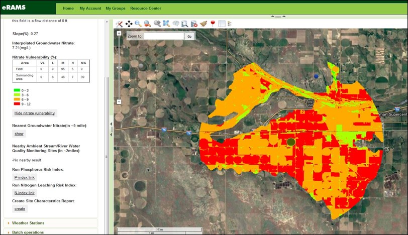
Once a field is mapped, EOFCP provides information on site characteristics that can show how nutrient management practices may impact water resources.
DATA
Soil data is retrieved from the USDA – Natural Resources Conservation Service (NRCS) Soil Survey Geographic Database (SSURGO).
Users can also choose climate data sources from:
- Parameter Elevation Regression on Independent Slopes Model (PRISM)
- Global Historical Climatology Network – Daily (GHCND)
- Colorado Agricultural Meteorological Network
EOFCP integrates the Phosphorus Index, Nitrogen Index, Soil and Water Assessment Tool (SWAT) model, Water Irrigation Scheduler for Efficiency (WISE), Land Use and Agricultural Management Practice Service (LAMPS), and other technologies into a single geospatial application for comprehensive analysis.