Colorado Stormwater Infrastructure Catalog
The Colorado Stormwater Infrastructure Catalog (CSIC) is a web-based platform hosted on the eRAMS infrastructure, designed to store, share, and display storm sewer geospatial data among Colorado Stormwater Council (CSC) members. This central repository fills data gaps between neighboring municipalities, facilitating cooperation on regional water quality and master drainage planning.
Key Features:
- Cross-jurisdictional data sharing: View storm sewer systems across MS4 boundaries.
- Illicit discharge tracking: Investigate discharges that overlap with adjacent jurisdictions.
- Asset management support: Coordinate operations and access data for Construction Improvement Project (CIP) design.
- Emergency response planning: Enable communication between managers during disasters such as flooding.
- Standardized infrastructure mapping: Classify assets into types such as Inlets, Pipes, and Detention Ponds.
Outputs
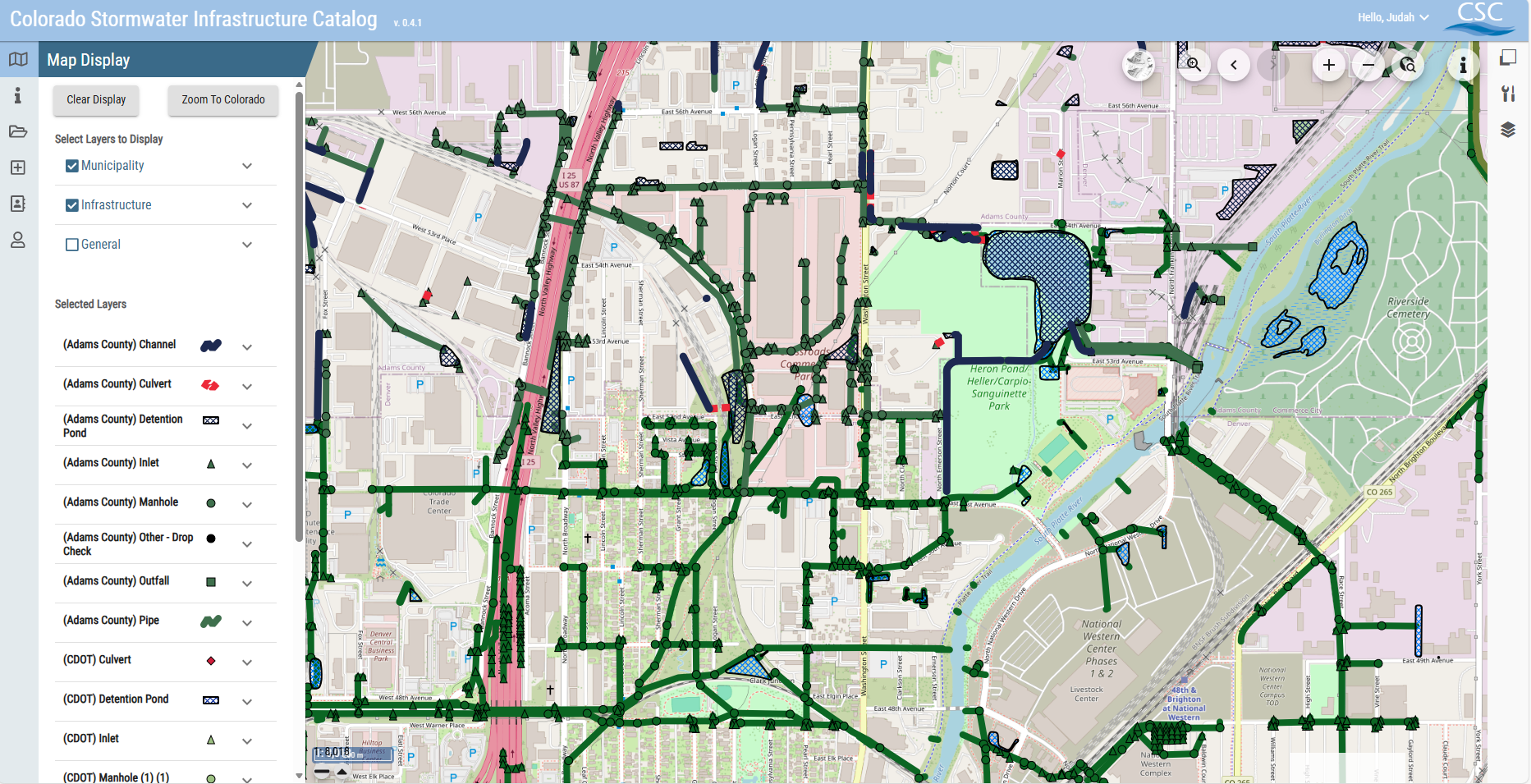
CSIC enhances the regulated community’s ability to visualize stormwater systems by standardizing disparate GIS data into a consistent “Global Display”. Administrative users classify their uploaded layers into standard infrastructure types—including Inlets, Manholes, Outfalls, Pipes, Culverts, Channels, and Detention Ponds—to ensure consistent symbology across the state.
The tool supports strategic decision-making by allowing users to examine transitions from upstream or downstream jurisdictions, which is critical for improving storm sewer maps and tracking illicit discharges. Additionally, CSIC serves as a planning tool for watershed and stream corridor plans, allowing non-standard MS4 communities to access surrounding mapping data for potential cost savings.