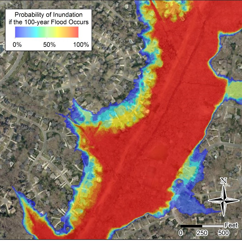
Probabilistic Flood Inundation Maps
Authors
- Brian Bledsoe – University of Georgia
- Tim Stephens – University of Georgia
Purpose
Flood hazard estimates obtained from hydraulic models are inherently uncertain. Quantifying the uncertainty in flood hazard estimates can identify areas of elevated or hidden risk that are not made known by deterministic depictions.
Description
Probabilistic flood hazard maps depict the probability of inundation given the occurrence of the 1% annual exceedance probability flood event (100-year flood). Probabilities are determined from Monte-Carlo simulations of flood hydraulics that reflect uncertainty in flood magnitude, friction parameters, and channel change. One-dimensional steady flow hydraulics are simulated in the Hydrologic Engineering Center’s River Analysis System (HEC-RAS).
Stephens, T. A., & Bledsoe, B. P. (2020). Probabilistic mapping of flood hazards: Depicting uncertainty in streamflow, land use, and geomorphic adjustment. Anthropocene, 29, 100231. https://doi.org/10.1016/j.ancene.2019.100231.
Scenarios
Different datasets are provided for different modeling techniques used to estimate flood magnitude: stationary flood frequency analysis, nonstationary flood frequency analysis, a hydrologic model, and a regional flood regression equation. Each dataset represents a different distribution of discharge uncertainty, and a similar distribution of uncertainty in friction parameters and channel change.
Attributes
Raster (.tif) of probabilities indicating inundation likelihood given the occurrence of the 1% annual exceedance probability flood. Grid resolution is 5 feet for a 2 mile reach of McMullen Creek, Charlotte, NC.
FFA.tif: uncertainty in discharge (stationary flood frequency analysis) + channel change + friction parameters

