Urban Vegetation and Regional Climate
Authors
- Darrel Jenerette – University of California Riverside
- Peter Ibsen – University of California Riverside
Purpose
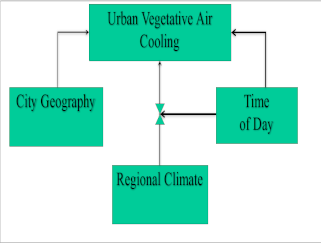
Determine how local city wide vegetation derived near-surface air temperature cooling responds to regional climate.
Description
Air Temperature
Region: Nationwide
Scale: City
Data:
• 3 months of hourly microclimate (Air Temperature & Relative Humidity) in 8 cities.
o ~100 air temperature sensors in each city
o ~20 relative humidity sensors in each city
• GPS Locations of each sensor
• Cities
o Los Angeles
o Las Vegas
o Phoenix
o Tucson
o Portland
o Baltimore
o Denver
o Miami
• Satellite derived vegetation density (Normalized Difference Vegetation Index, NDVI)
• Satellite derived land surface temperature (LST)
• Calculated Vapor Pressure Deficit (VPD, kPa)
Attributes
e.g., daily precipitation, land cover, water rate, etc.
Air Temperature (Tair; °C)
Relative Humidity (RH)
Vegetation density (NDVI)
Calculated Vapor Pressure Deficit (VPD; kPa)
Satellite derived vegetation density (Normalized Difference Vegetation Index, NDVI, 30m2 pixel size)
Satellite derived land surface temperature (LST, 30m2 pixel size)