Regional Climate Projections – South Platte River Basin, Colorado
Authors
-
Mazdak Arabi – Colorado State University
-
Hadi Heidari – Colorado State University
Purpose
Climate and land use changes can significantly affect water resource availability caused by lack of precipitation and high evaporation. Climate model outputs are commonly used to forecast the effect of climate change on specific hydrologic processes over the course of the next several decades. At a global scale, the hydrologic component of coarse-resolution general circulation models (GCMs) may be taken directly. However, this approach may not be adequate for finer spatial-scale hydrological. The use of climate projections at the regional or watershed level typically involves either the application of hypothetical incremental changes to historic observations or downscaling the outputs of GCMs in space, either statistically or dynamically.
Description
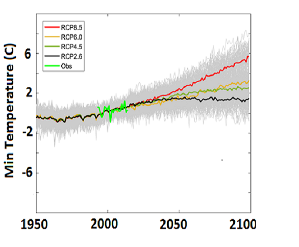
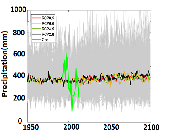
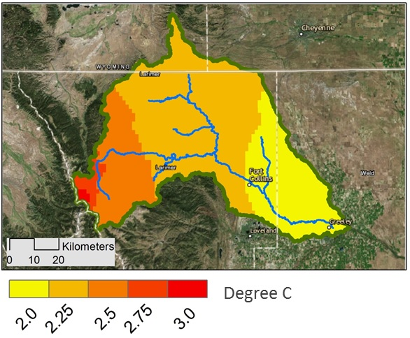
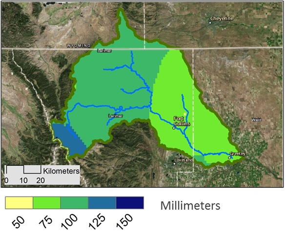
We have developed an extensive dataset of 230 high-resolution climate projections for the South Platte River Basin. Existing dynamically downscaled projected climate data available at a monthly time-step and 1/8⁰-grid spatial resolution were obtained from the World Climate Research Programme’s (WCRP’s) Coupled Model Intercomparison Project Phase 5 (CMIP5) multi-model dataset. The bias introduced by using coarse-grid areal-average climate data at the point level was calculated and removed using the Quantile Mapping (QM). This procedure ensured that the areal-averaged climate projections from GCMs over the 1950-2015 period were consistent with actual observations of precipitation and temperature at meteorological stations within the SPRB. A dataset of 45 meteorological stations from NOAA, CoAgMet, and Northern Water Conservancy District stations was used to conduct the spatial downscaling. Next, each scenario was temporally downscaled from monthly to daily time-step using a resampling and scaling/incrementing.